
listed by backcountry zone
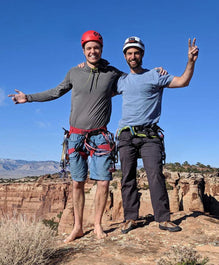
Community Channels
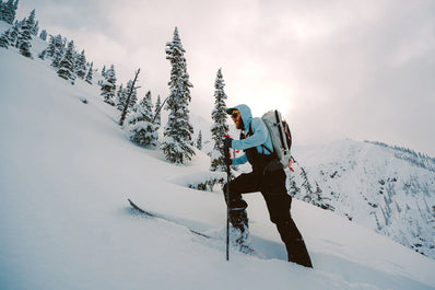
A Community Channel is a radio channel designated for a specific backcountry zone, meant for vital group-to-group communication and safety information like an accident, avalanche, or other hazard. They are also known as "group monitoring channels" or " common-use radio channels".
Please note: Community Channels are just gaining traction—we'll be adding channels across zones and backcountry activities (like popular climbing areas) as we receive more information. We're immensely grateful to the avalanche centers, mountain clubs, and individuals linked below who have organized channels for their communities.
If you’d like to contribute to this page, please use this form to reach out to our team.
FAQ
+Examples of standard usage between groups:
- Information regarding potential hazards or critical snow & avalanche information
- When your group is entering complex terrain
- When your group is clear of a given line or area, alerting other groups of a clear run-out zone
Examples for emergency situations:
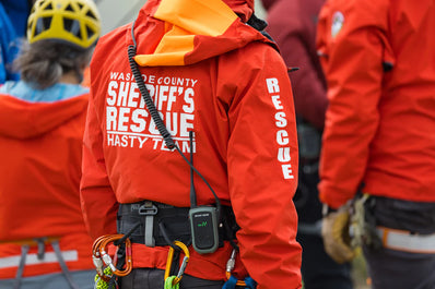
Send a distress call for assistance in case of an accident
Request another group to call 911 or mount an organized rescue if 911 can’t be reached directly
Each backcountry zone has a designated channel and privacy code (also know as sub-channel).
When using an FRS or GMRS radio that uses channel numbers, connect to the channel & privacy code. For example, 1:3 means channel 1, privacy code 3. A privacy code of zero means that the privacy code is off for the zone.
If you're using a radio that uses frequency numbers, reference the corresponding frequency column.
Each zone has a reference link to more information and many include detailed maps.
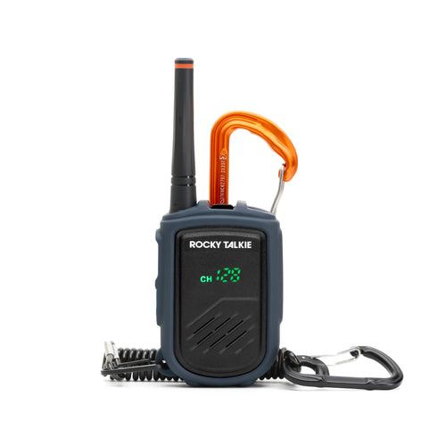
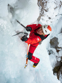
If you have the Mountain Radio, we recommend setting your radio to the community channel and refrain from unnecessary chatter within your group.
If you have the Expedition Radio, we recommend using the Dual Channel Watch feature which allows you to monitor two different channels at the same time and easily swap between them to transmit. Follow these instructions to set it up:
- Unlock the radio and use the Channel Flipper to select the primary channel. This will become your A channel when Dual Channel Watch mode is active. We recommend using the A channel for private communication within our own group.
- Hold the A/B button down until the A/B icon flashes on the display.
- Use the Channel Flipper to select the channel you’d like to monitor for B - this will be the community channel. Press any button to continue.
- CT DCS will be flashing. Use the Channel Flipper to select a privacy code for your B channel.
- Press any button to save the selection. To turn off A/B mode, repeat step 1 and use the Channel flipper to select OFF. Press any button to confirm.
California
+| Backcountry Zone | Channels | Channel Frequency (Mhz) | Privacy Code Frequency (Mhz) |
|---|---|---|---|
| Donner Summit North (Red) | 16-30 | 462.575 | 186.2 |
| Deep Creek (Red) | 16-30 | 462.575 | 186.2 |
| Blackwood Canyon (Red) | 16-30 | 462.575 | 186.2 |
| Emerald Bay South (Red) | 16-30 | 462.575 | 186.2 |
| Freel Peak (Red) | 16-30 | 462.575 | 186.2 |
| Luther Pass South (Red) | 16-30 | 462.575 | 186.2 |
| Mount Rose South (Red) | 16-30 | 462.575 | 186.2 |
| Johnson Canyon/Tahoe-Donner (Green) | 18-30 | 462.625 | 186.2 |
| Pole Creek (Green) | 18-30 | 462.625 | 186.2 |
| Sugar Pine (Green) | 18-30 | 462.625 | 186.2 |
| Tallac (Green) | 18-30 | 462.625 | 186.2 |
| Carson Pass North (Green) | 18-30 | 462.625 | 186.2 |
| Mount Rose North (Green) | 18-30 | 462.625 | 186.2 |
| Donner Summit South (Blue) | 20-30 | 462.675 | 186.2 |
| Scott Peak (Blue) | 20-30 | 462.675 | 186.2 |
| Desolation (Blue) | 20-30 | 462.675 | 186.2 |
| Carson Pass South (Blue) | 20-30 | 462.675 | 186.2 |
| Rubicon (Blue) | 20-30 | 462.675 | 186.2 |
| Carpenter Valley (Purple) | 22-30 | 462.725 | 186.2 |
| Coldstream Canyon (Purple) | 22-30 | 462.725 | 186.2 |
| Ward Canyon (Purple) | 22-30 | 462.725 | 186.2 |
| Emerald Bay North (Purple) | 22-30 | 462.725 | 186.2 |
| Luther Pass North (Purple) | 22-30 | 462.725 | 186.2 |
Colorado: Front Range
+| Backcountry Zone | Channel : Privacy Code | Channel Frequency (Mhz) | Privacy Code Frequency (Mhz) |
|---|---|---|---|
| Berthoud Pass | 1 : 1 | 462.5625 | 67.0 |
| Current Creek | 1 : 2 | 462.5625 | 71.9 |
| Second & First Creek | 1 : 3 | 462.5625 | 74.4 |
| No Name Peak | 1 : 4 | 462.5625 | 77.0 |
| Mines Peak | 1 : 5 | 462.5625 | 79.7 |
onX Map Layer: Berthoud Pass
Source: Front Range V1
| Backcountry Zone | Channel : Privacy Code | Channel Frequency (Mhz) | Privacy Code Frequency (Mhz) |
|---|---|---|---|
| Coon Hill | 7 : 1 | 462.7125 | 67.0 |
| Dry Gulch | 7 : 2 | 462.7125 | 71.9 |
| Herman Gulch | 7 : 3 | 462.7125 | 74.4 |
| Woods Creek | 7 : 4 | 462.7125 | 77.0 |
| Watrous Gulch | 7 : 5 | 462.7125 | 79.7 |
| Ruby Gulch | 7 : 6 | 462.7125 | 82.5 |
Source: Front Range V1r
Source: Front Range V1r
| Backcountry Zone | Channel : Privacy Code | Channel Frequency (Mhz) | Privacy Code Frequency (Mhz) |
|---|---|---|---|
| Loveland Pass North | 6 : 1 | 462.6875 | 67.0 |
| Loveland Pass South | 6 : 2 | 462.6875 | 71.9 |
| Grizzly Gulch | 6 : 3 | 462.6875 | 74.4 |
| Stevens Gulch | 6 : 4 | 462.6875 | 77.0 |
| Tiptop Peak | 6 : 5 | 462.6875 | 79.7 |
Source: Front Range V1
| Backcountry Zone | Channel : Privacy Code | Channel Frequency (Mhz) | Privacy Code Frequency (Mhz) |
|---|---|---|---|
| Jones Pass | 2 : 1 | 462.5875 | 67.0 |
| Butler | 2 : 2 | 462.6875 | 71.9 |
| West Fork | 2 : 3 | 462.6875 | 74.4 |
Source: Front Range V1
The Colorado Search & Rescue Association has designated Channel 3.0 as the default radio channel for Colorado backcountry emergencies.
Colorado: Central Mountains
+| Backcountry Zone | Channel : Privacy Code | Channel Frequency (Mhz) | Privacy Code Frequency (Mhz) |
|---|---|---|---|
| Crested Butte | 7 : 0 | 462.7125 | 0.0 |
Source: Crested Butte Avalanche Center
The Colorado Search & Rescue Association has designated Channel 3.0 as the default radio channel for Colorado backcountry emergencies.
Colorado: SW / San Juan Mtns
+| Backcountry Zone | Channel : Privacy Code | Channel Frequency (Mhz) | Privacy Code Frequency (Mhz) |
|---|---|---|---|
| Lizard Head Pass | 4 : 1 | 462.6375 | 67.0 |
| Other Zones | 5 : 1 | 462.6625 | 67.0 |
Source: Telluride Mountain Club
| Backcountry Zone | Channel : Privacy Code | Channel Frequency (Mhz) | Privacy Code Frequency (Mhz) |
|---|---|---|---|
| Waterfall Canyon | 2 : 1 | 462.5875 | 67.0 |
| Swamp Canyon | 2 : 2 | 462.5875 | 71.9 |
| Opus Hut Area | 2 : 3 | 462.5875 | 74.4 |
Source: Telluride Mountain Club
| Backcountry Zone | Channel : Privacy Code | Channel Frequency (Mhz) | Privacy Code Frequency (Mhz) |
|---|---|---|---|
| Battleship | 2 : 3 | 462.5875 | 74.4 |
| Anvil | 2 : 4 | 462.5875 | 77.0 |
| Chatty West | 6 : 1 | 462.6875 | 67.0 |
| Chatty East | 6 : 2 | 462.6875 | 71.9 |
| Senator | 7 : 3 | 462.7125 | 74.4 |
| McMillan | 7 : 2 | 462.7125 | 71.9 |
| Commodore | 7 : 4 | 462.7125 | 77.0 |
| Reds | 7 : 1 | 462.7125 | 67.0 |
| Ironton West | 15 : 1 | 462.55 | 67.0 |
| Ironton East | 15 : 2 | 462.55 | 71.9 |
| Abrams | 15 : 3 | 462.55 | 74.4 |
| Richmond | 16 : 1 | 462.575 | 67.0 |
| Upper Camp Bird | 16 : 2 | 462.575 | 71.9 |
| Stoney | 16 : 3 | 462.575 | 74.4 |
| Sneffels | 16 : 4 | 462.575 | 77.0 |
| Weehawken | 16 : 5 | 462.575 | 79.7 |
Source: Chris & Kaden
| Backcountry Zone | Channel : Privacy Code | Channel Frequency (Mhz) | Privacy Code Frequency (Mhz) |
|---|---|---|---|
| Lower Bear Creek | 1 : 1 | 462.5625 | 67.0 |
| Upper Bear Creek | 1 : 2 | 462.5625 | 71.9 |
| Wasatch / La Junta Mountains | 1 : 3 | 462.5625 | 74.4 |
| Alta Lakes Area | 1 : 4 | 462.5625 | 77.0 |
Source: Telluride Mountain Club
The Colorado Search & Rescue Association has designated Channel 3.0 as the default radio channel for Colorado backcountry emergencies.
New Hampshire
| Backcountry Zone | Channel : Privacy Code | Channel Frequency (Mhz) | Privacy Code Frequency (Mhz) |
|---|---|---|---|
| Tuckerman Ravine | 22 : 0 | 462.725 | 0.0 |
| Gulf of Slides | 21 : 0 | 462.700 | 0.0 |
| East Snowfields & Raylond Cataract | 20 : 0 | 462.675 | 0.0 |
| Huntington Ravine | 19 : 0 | 462.650 | 0.0 |
| Great Gulf | 18 : 0 | 462.625 | 0.0 |
| Burt Ravine | 17 : 0 | 462.600 | 0.0 |
| Ammonoosuc Ravine | 16 : 0 | 462.575 | 0.0 |
| Okakes Gulf/Dry River | 15 : 0 | 462.550 | 0.0 |
| Crawford Notch | 14 : 0 | 467.7125 | 0.0 |
| Franconia Notch | 13 : 0 | 467.6875 | 0.0 |
| Evans Notch | 12 : 0 | 467.6625 | 0.0 |
| GBA Glades | 11 : 0 | 467.6375 | 0.0 |
Source: Northeast Alpine Start
Utah
| Backcountry Zone | Channel : Privacy Code | Channel Frequency (Mhz) | Privacy Code Frequency (Mhz) |
|---|---|---|---|
| Little Cottonwood Canyon/Highway 210 | 2 : 10 | 462.5875 | 94.8 |
| Big Cottonwood Canyon/Highway 190 | 1 : 9 | 462.5625 | 91.5 |
| Park City Ridgeline/Highway 224 | 2 : 24 | 462.5875 | 151.4 |
| Rescue Channel (when a rescue is underway) | 9 : 11 | 467.5875 | 97.4 |
Source: Utah Avalanche Center
Washington
| Backcountry Zone | Channel : Privacy Code | Channel Frequency (Mhz) | Privacy Code Frequency (Mhz) |
|---|---|---|---|
| Source & Snow Lake Environs | 2 : 7 | 462.5875 | 85.4 |
| Kendall Zone | 3 : 7 | 462.6125 | 85.4 |
| Hyak | 6 : 7 | 462.6875 | 85.4 |
Source: Northwest Avalanche Center
Wyoming
The Wyoming Search and Rescue Council has designated Channel 3.7 as the default radio channel for Wyoming backcountry emergencies.